
Project Update:  Community WIld Fire Protection Plan 

The Community Wildfire Protection Plan is almost complete!  Please review the CWPP Draft here: 
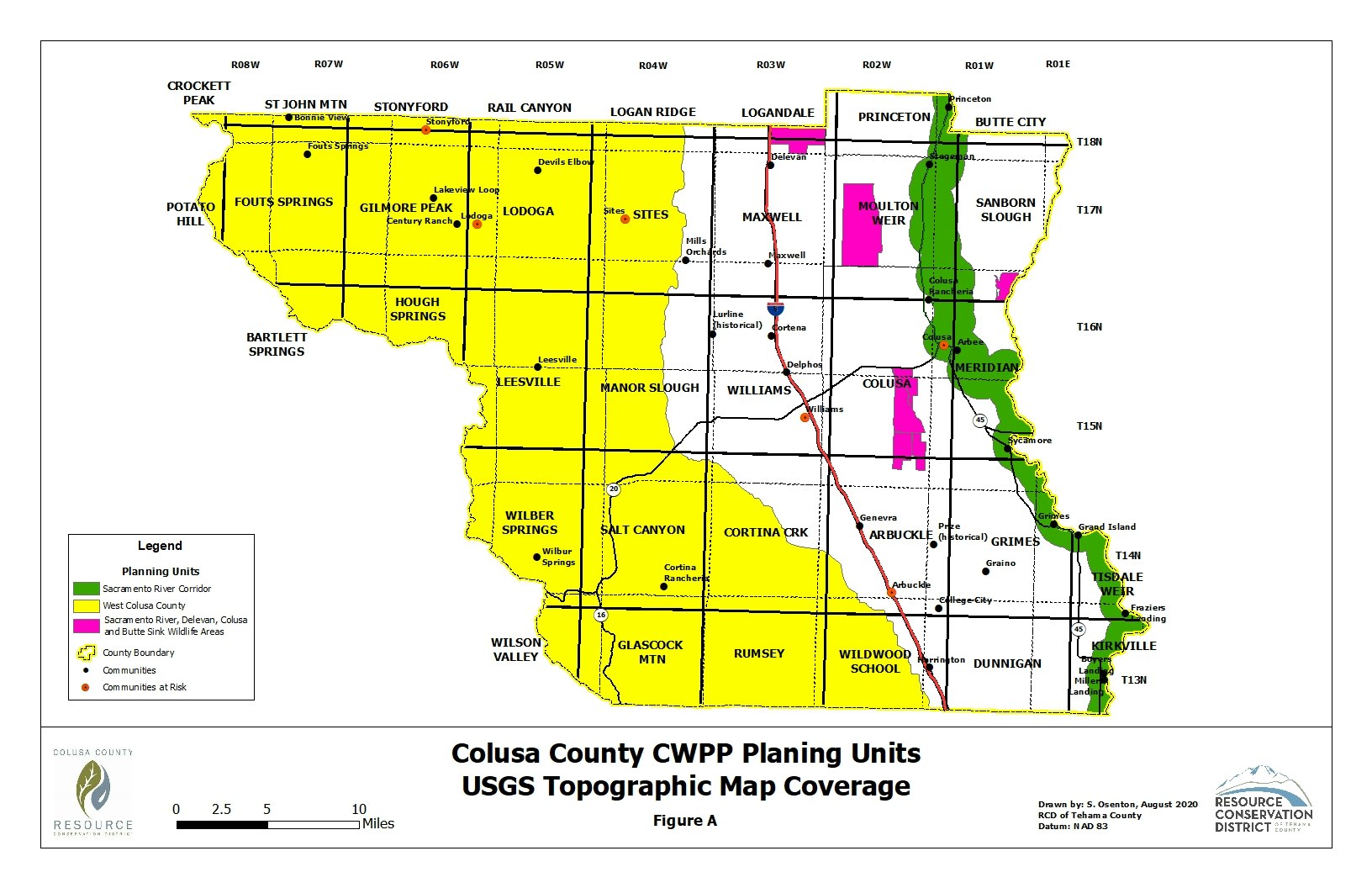
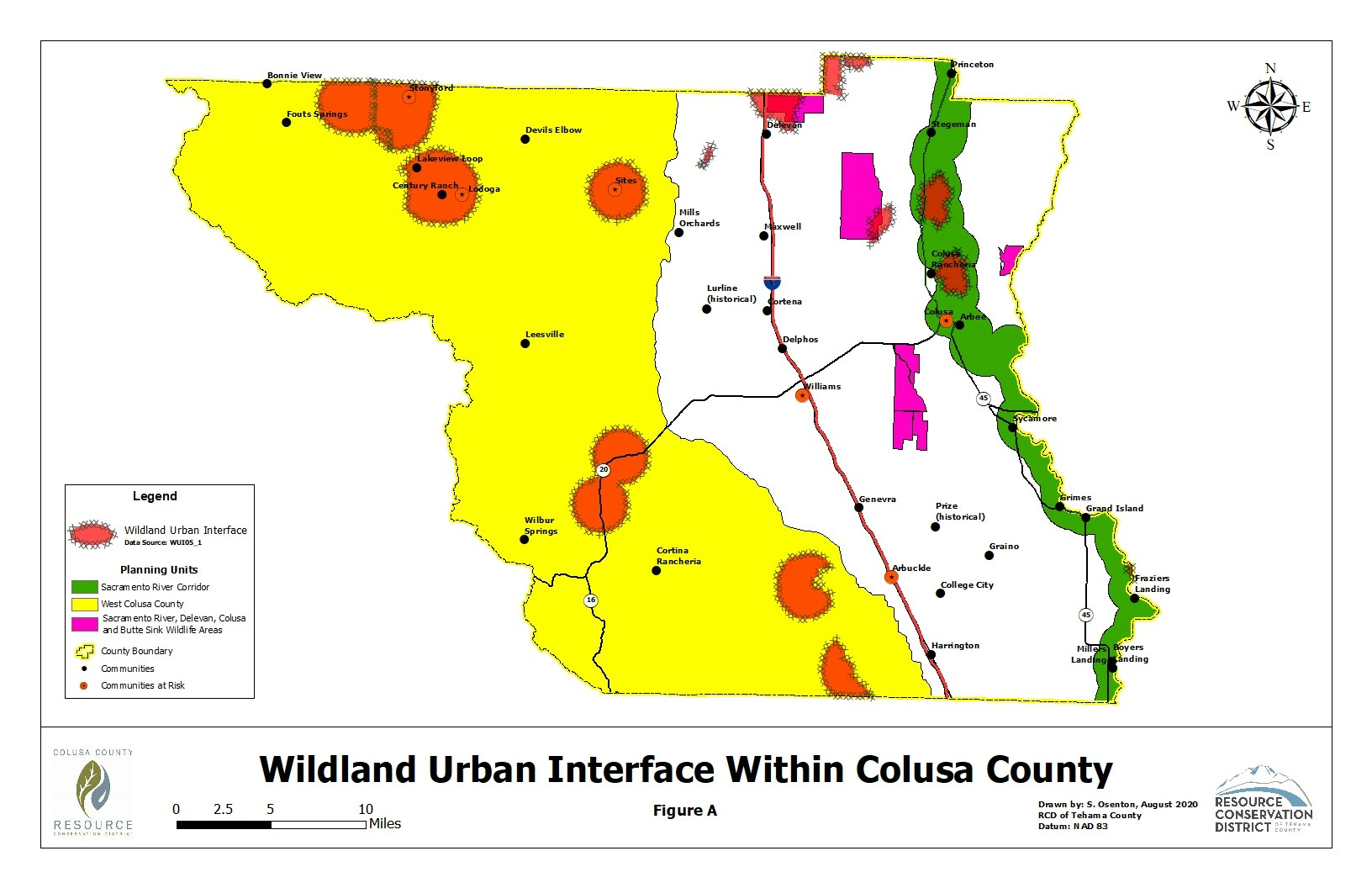
CWPP v.6 .rtf

Please review the CWPP Maps below:

Map of Colusa County showing planning units and topographic features, highlighted by different colors for various land areas.
The image depicts a map of Colusa County, showing fire history from 1950 to 2019 with color-coded legend for various years.
The map shows fire threat levels in Colusa County, indicating areas of moderate to very high risk.
Map of the Wildland Urban Interface in Colusa County, showing areas at risk, planning units, and community boundaries.

 If you have any suggestions, additions, questions, or concerns about the CWPP please contact Liz Harper at the CCRCD.